

Hurricane Melissa made landfall in Jamaica on Tuesday afternoon as a Category 5 hurricane — one of the most powerful hurricane landfalls on record in the Atlantic basin.
After landfall, the storm was eventually downgraded to a Category 3 hurricane before restrengthening into a Category 4 storm late Tuesday as it barreled toward Cuba where it was expected to make a second landfall.
Here is Melissa’s projected path:
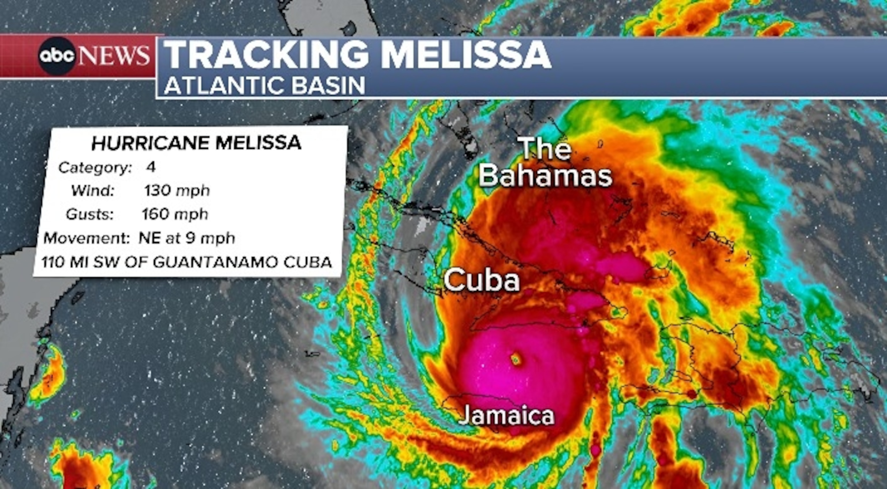
Melissa is now a Category 4 hurricane, with maximum sustained winds of 130 mph.
On the latest forecast track, Melissa was expected to make landfall in eastern Cuba as a Category 4 overnight and move through Cuba through Wednesday morning.
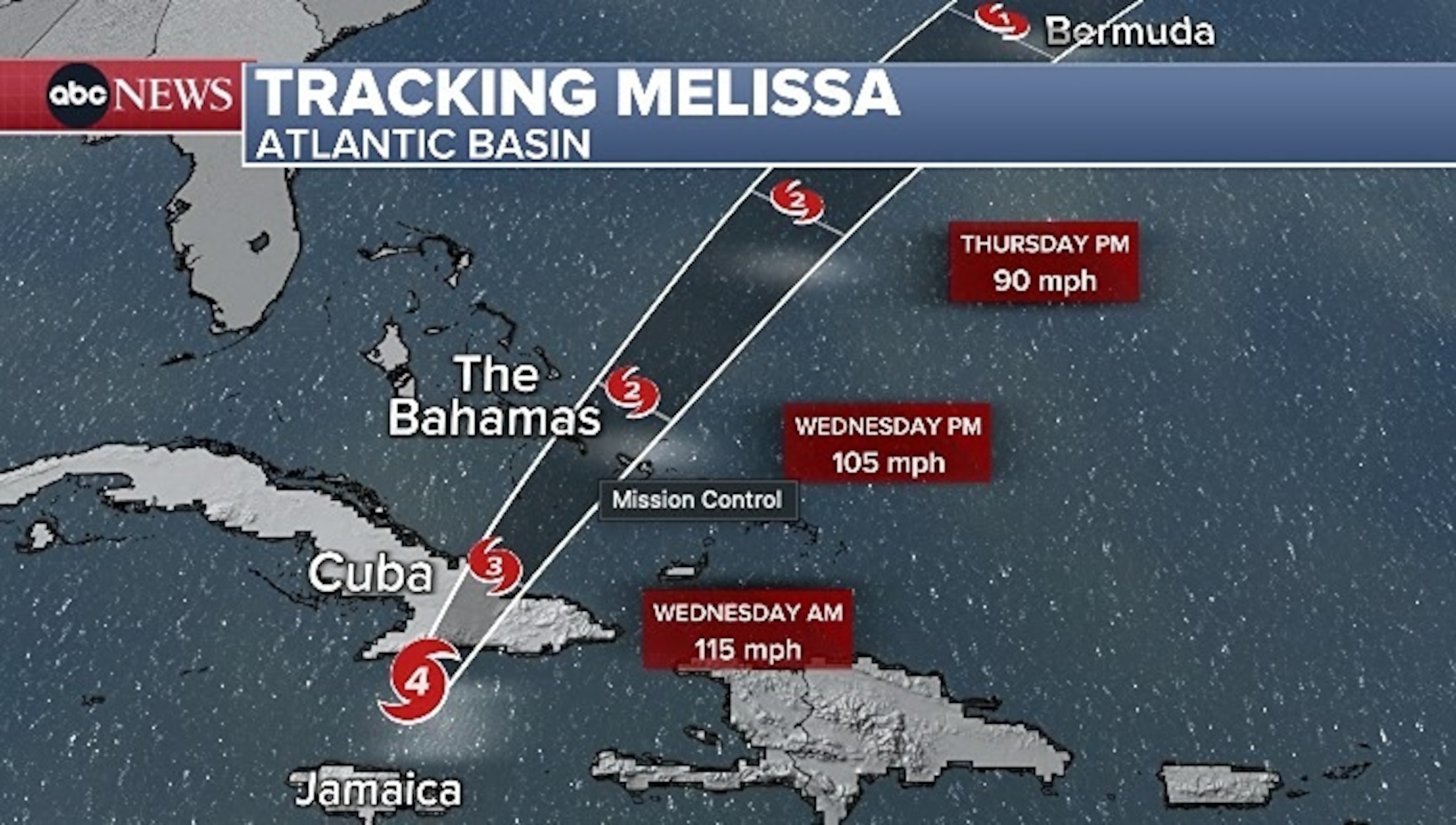
Melissa is expected to reemerge over water on Wednesday and approach the Bahamas as either a Category 2 or Category 3 hurricane through Wednesday night.
By Wednesday night, Melissa is forecast to be back over the open Atlantic before approaching Bermuda by Thursday evening as a possible Category 2 hurricane.
By late early Friday morning Melissa will be passing Bermuda as a Category 1 hurricane and then continue out to sea.
Melissa brought 15 inches to 30 inches of rain to Jamaica on Tuesday, with localized storm totals up to 40 inches.
Up to 25 inches of rain was possible for Cuba and up to 10 inches possible for the Bahamas.
These totals could result in life-threatening flash flooding with numerous landslides possible in Jamaica and Cuba from Tuesday through Wednesday.
There is the potential for significant storm surge up to 12 feet along the southeast coast of Cuba from Tuesday night into Wednesday, along with large and destructive waves.
The East Coast may experience rip currents, rough surf and some beach erosion this week as Melissa heads out to sea.
ABC News: Top Stories
Read the full article .
