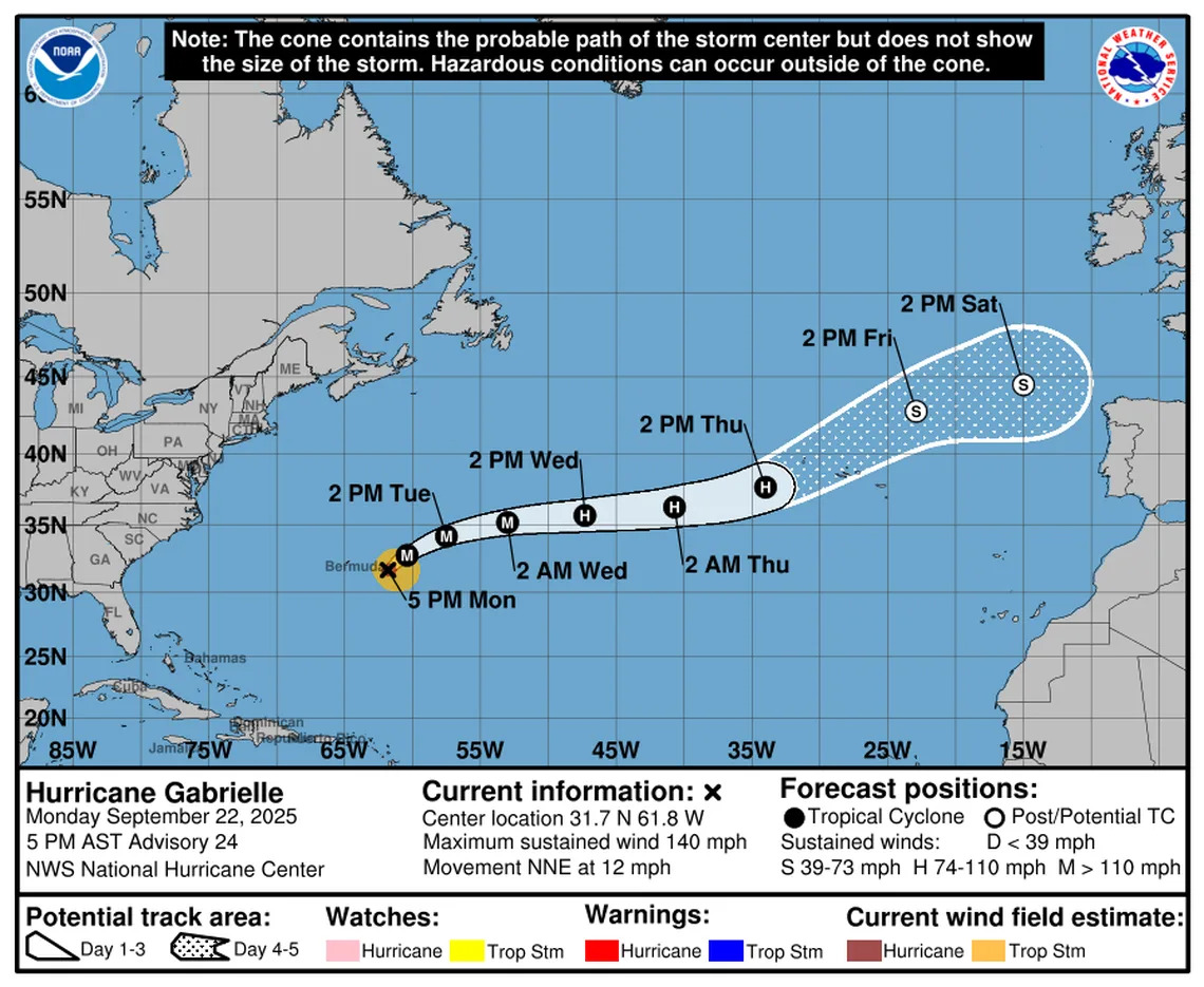
Two tropical waves with decent chances of developing into something stronger are swirling in the Atlantic, while Hurricane Gabrielle slips to the east of Bermuda over the next few days as a Category 4 — the second major storm of the season.
As of 2 p.m. Monday, the National Hurricane Center upped the chances for both waves to form into a tropical depression or storm this week.
Forecasters said the first tropical wave, which has been under watch for about a week now, has a 30% chance of strengthening into a tropical depression in the next two days and an 80% chance of formation in the next seven days.
The newer tropical wave, placed on NHC’s map over the weekend, has a 10% chance of development in the next two days and a 50% chance within the next seven days.
Long-range models suggest both waves will follow a similar pattern to Gabrielle and most other storms this year, a northern curve away from the Caribbean and East Coast.
However, the second tropical wave could potentially form a little farther west than the first one, raising the chances that some Caribbean islands would see impacts.

Forecasters say Gabrielle, which rapidly intensified from a Category 1 to a Category 4 storm on Monday, will pass well east of Bermuda, leaving high waves and rough surf the main issue for the island. Those waves could reach the southeastern coast of the U.S., potentially making the waters more dangerous to swim or boat in for the next few days.
As of 5 p.m. Monday, Hurricane Gabrielle was packing 140 mph sustained winds, but wasn’t expected to hold onto that strength for long. Forecasters expect Gabrielle to begin to weaken starting Tuesday, and by Saturday, the hurricane is expected to peter out in cooler waters.
Yahoo News – Latest News & Headlines
Read the full article .


