

Deadly flooding that impacted parts of the Southwest U.S. over the last couple of days continued easing with no flood alerts in effect for the area as of Saturday evening. However, with more monsoonal moisture on the way, the risk for flash flooding will increase for parts of the region on Sunday and Monday.
Another area of low pressure will bring more moisture into southern parts of California and Arizona on Sunday, elevating the threat for flash flooding. Even though the threat level is only marginal (a level 1 out of 4), isolated thunderstorms and periods of heavier rainfall could lead to some localized flooding in prone spots.
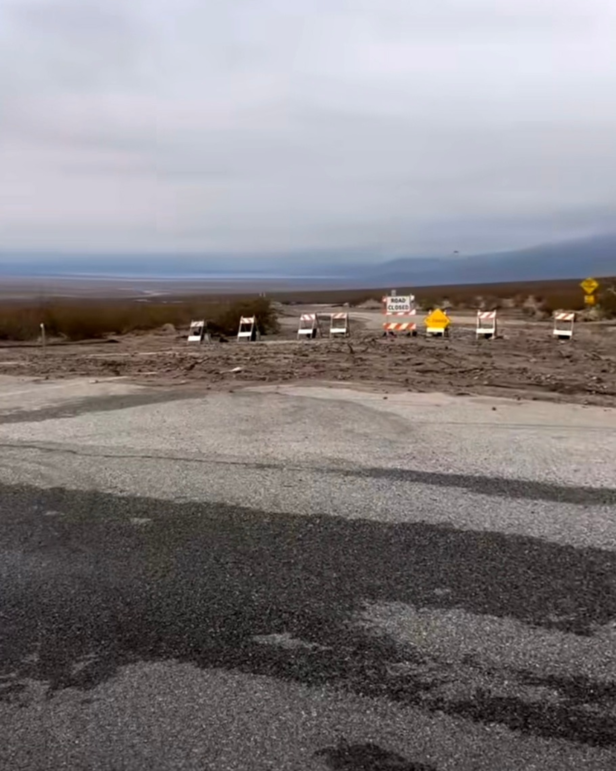
Over the last couple of days, heavy rain and flash flooding drenched the Southwest and even became deadly in one instance.
In Barstow, California, a 2-year-old was swept away after their family’s car was swept off a road and overtaken by floodwaters. After a 20-hour search, officials said the boy’s body was recovered.
Flash flooding occurred in other parts of the Southwest as the heaviest downpours dropped 1 to 2 inches of rain in around an hour for some spots, causing some roads to be washed out and anything in the way of rushing floodwaters to be swept away.
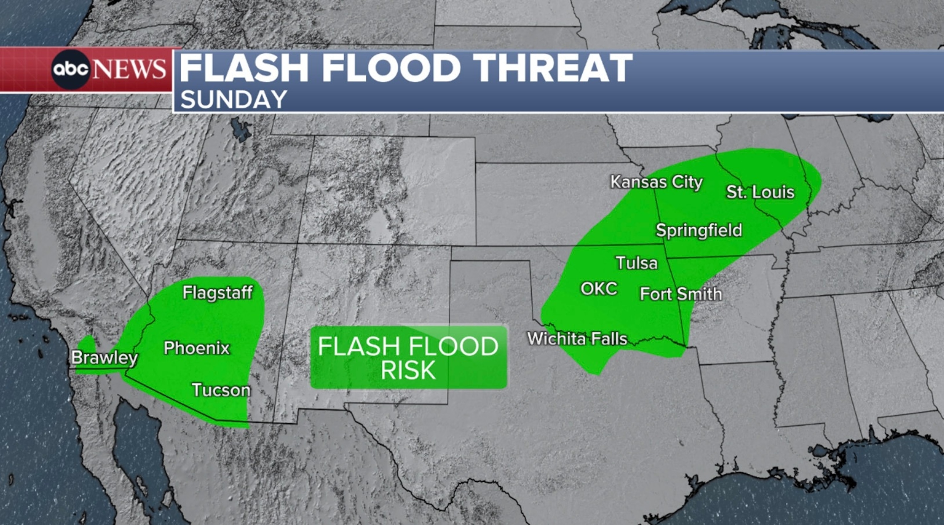
Looking ahead, the threat for flash flooding in the Southwest will shift farther east on Monday, covering a good portion of Arizona and western New Mexico, as shower activity increases over the region. Likewise, localized flash flooding can’t be ruled out, especially in flood-prone areas.
Any burn scar areas will be especially prone to dangerous flash flooding which could trigger debris flows and mudslides. Burned soil lowers the threshold for flash flooding, meaning even lower rainfall totals can lead to significant flash flooding and other impacts, which unfold quickly.
Meanwhile, the threat for flash flooding will also expand across the Central U.S. Monday into Tuesday, stretching from Kansas and Oklahoma all the way to Ohio.
Widespread, scattered showers and thunderstorms firing up and pushing through the Plains and Midwest could bring locally heavy downpours to parts of the region, which could in turn lead to flooding.
Tropical Storm Gabrielle
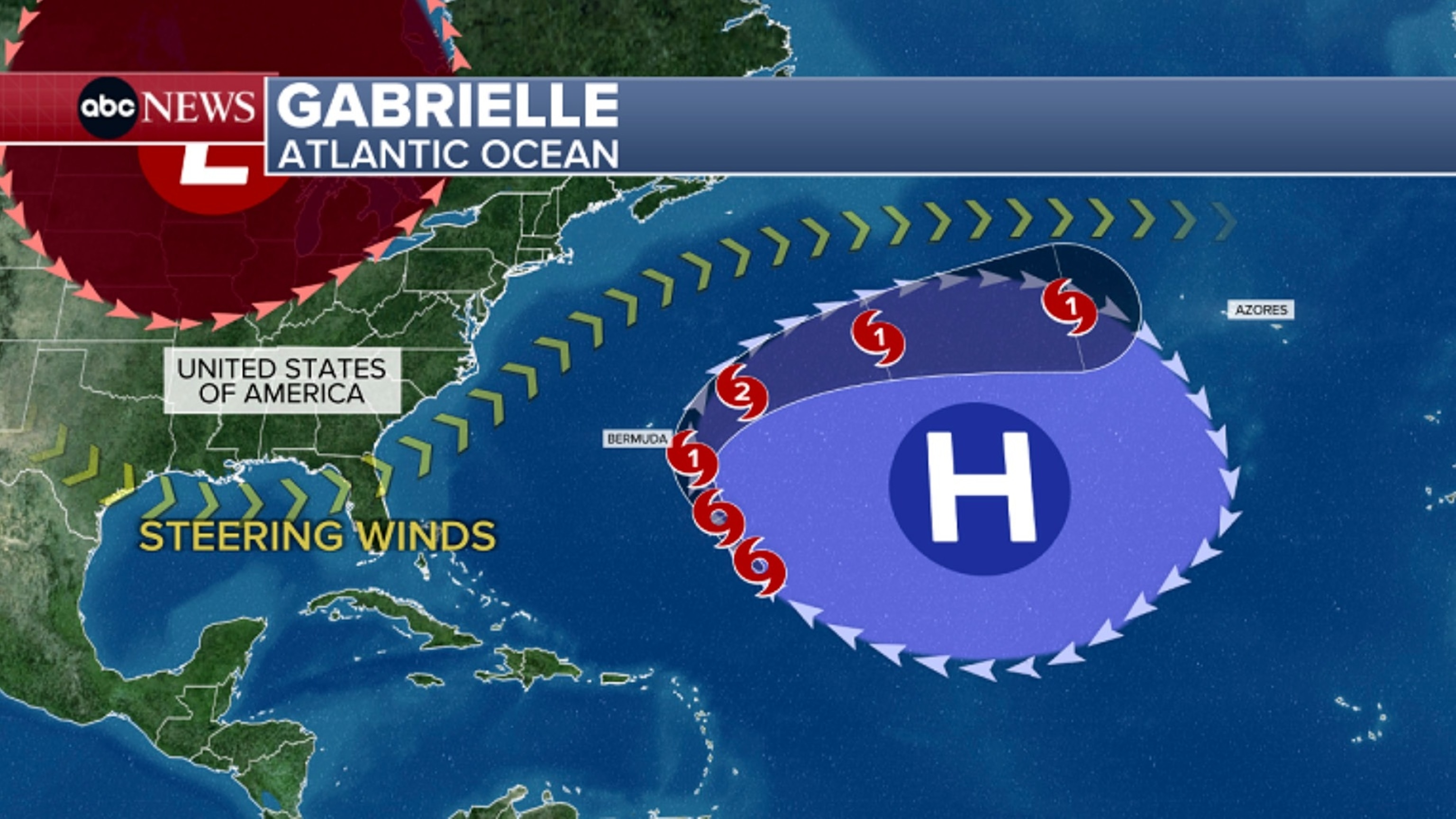
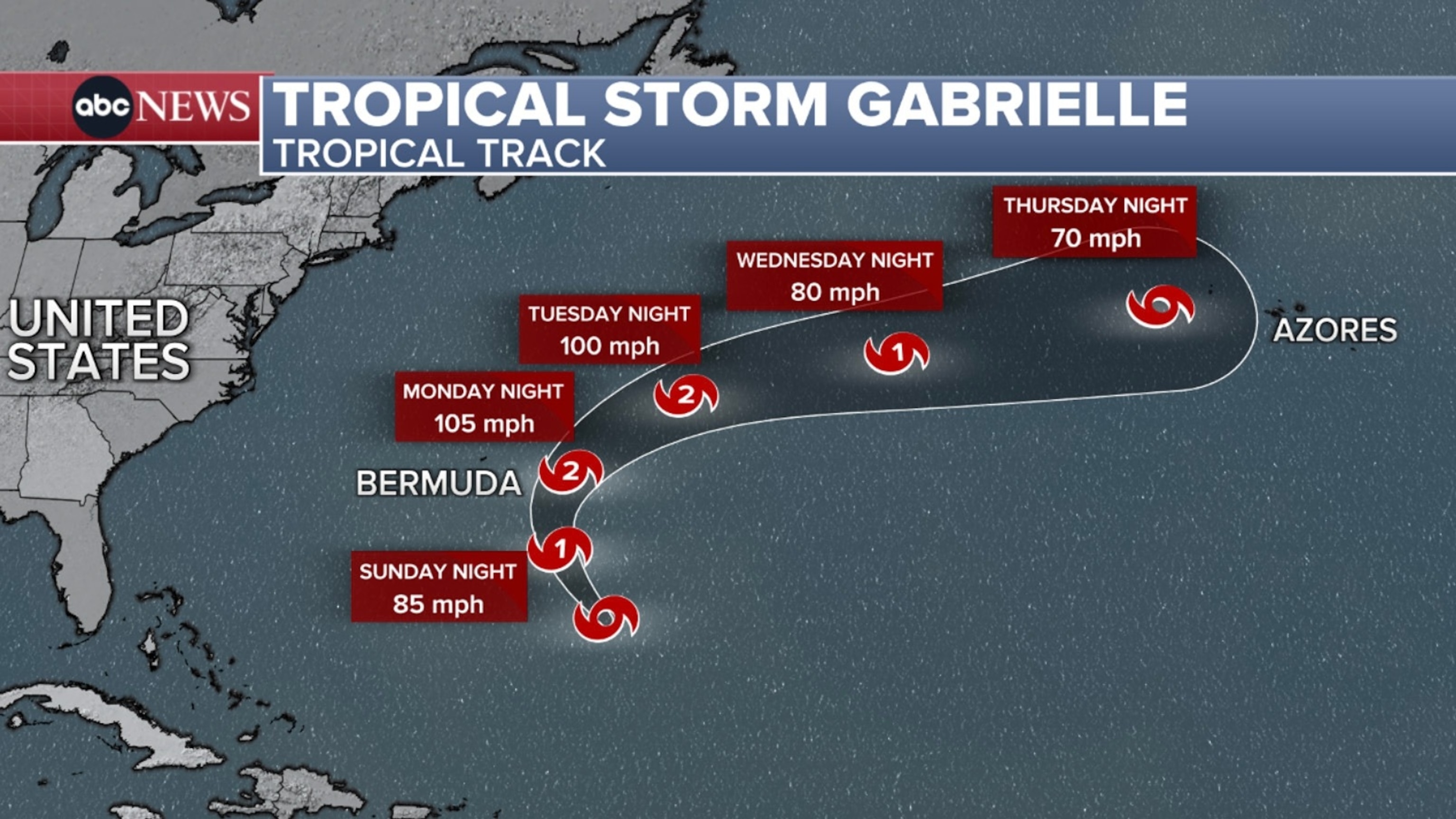
Tropical Storm Gabrielle continues to churn in the central Atlantic and will continue to strengthen. The storm is expected to become a hurricane either later Saturday night or Sunday.
If it does become a hurricane, Gabrielle would become the 2nd hurricane of the 2025 Atlantic hurricane season. On average, the 2nd hurricane forms around August 26, making this hurricane almost a month later than normally expected.
As of Saturday evening, Gabrielle was located about 580 miles southeast of Bermuda.
The center of the storm is expected to pass east of Bermuda early next week before taking on a more eastward trajectory across the north-central Atlantic by the midweek.
Popular Reads


At the very least, Gabrielle will impact Bermuda with dangerous surf, large swells and life-threatening rip currents as it passes east. However, the storm’s outer bands could still clip the island Sunday night into Monday, bringing rainfall and wind impacts as well.
Even though Gabrielle will not have any direct impacts to the U.S. mainland, it will still generate rough surf and life-threatening rip currents along the East Coast, from North Carolina up through Maine later this weekend into next week.
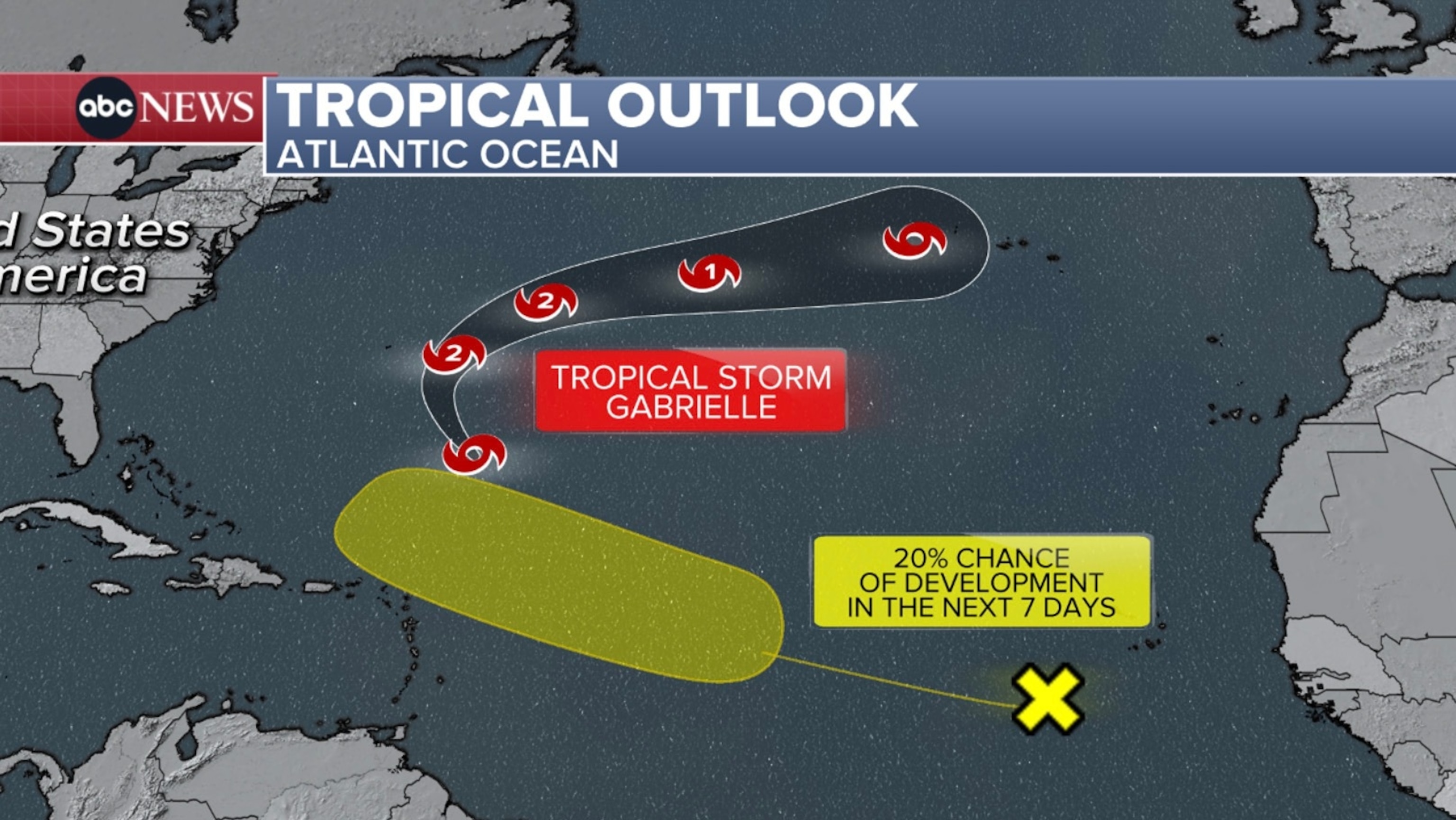
The National Hurricane Center is also watching a weak tropical wave located off the west coast of Africa as it produces some disorganized thunderstorms.
It has a 20% chance of development in the next seven days as it slowly treks across the central Atlantic. While it could take a similar track as Gabrielle, further details regarding its development and path remain uncertain at this time. Until then, this disturbance will continued to be monitored closely.
Tropical activity in the Atlantic is forecasted to slowly ramp back up over the next few weeks as conditions gradually become more favorable for development.
The Atlantic hurricane season runs through Nov. 30.
ABC News: Top Stories
Read the full article .
